Back on the CDT! Atlas’ first long-distance hiking adventure. 90 miles of incredible beauty. Massive vistas of granite peaks, wildflowers and pristine lakes. Dramatic sunrises, sunsets and thunderstorms. Crossing Knapsack Col and Texas Pass were highlights. The Wind River Range is unlike any place I’ve been, put it on your bucket list!
Day 1
Green River Lakes TH to Upper Green River Lake
3 miles
The drive to the north end of the Wind River Range from Salt Lake City couldn’t have gone quickly enough. I was so excited to get back on the CDT and go on this adventure through the Winds. If you’re reading my CDT adventures by state/segment, you’ll notice that I left the CDT going southbound at Green River Lakes in late Aug 2016 and rejoined the trail in Steamboat Springs, Colorado; I was concerned that I’d be getting too late to get through Colorado before the snow. I’m back this time to section hike from Green River Lakes to Atlantic City, with a resupply at Big Sandy Lodge, only this time I’ve got my 1 year old puppy, Atlas, in tow.
Atlas was ready to stretch his legs by the time we hit the trailhead. Little did he know it would be 130 miles of leg stretching that he’d be getting before we got back into our car! Backpacks on and ready to go, we hit the trail at 7 p.m. With only an hour and a half of light, we needed to get a few quick miles in.
We hiked until the last rays of light left the sky then found a great spot to camp above Upper Green River Lake. I’m back in Grizzly Bear country in the north-end of this range, so Atlas and I went looking for a good tree to hang our food in. Hoisting up 8 days of my food plus 8 days of his food on one rope wasn’t something I’d turned my mind to and proved to be much more difficult than I could have imagined, however I got it up in the air and secured for the night. Atlas was totally confused and had no idea why his backpack and my food bags were spinning around up in a tree. He kept barking and growling at it.


Day 2
Upper Green River Lake to Peak Lake
15.5 Miles
Atlas was up and ready for action at 5:30 a.m. I let him out of the tent and then zipped myself back in so I could get organized without his curious nose sticking itself into everything. I’d done a few practice backpacking trips earlier this summer and figured out a lot about how to backpack with a dog, but I knew coming into this trip that backpacking with a 1yr old puppy was going to be a new experience- for both of us!
I was pleased to see that my food bag hanging had held up overnight, but Atlas was still unnerved about the whole situation and started barking and growling when I lowered our stuff out of the tree. It was pretty funny.
The first 8 miles was a really mellow cruise up the valley and we made good time. I’ve been along this section of trail before, but it was still such a treat to be walking through such a picturesque valley, the trail passing through pine forests and following the meandering Green River towards then past Square Top Mountain.
I was concerned about what would happen if Atlas ran into a Grizzly bear, so I put a bear bell on his backpack and he jingle-jangled along making enough noise that at least we wouldn’t surprise the bear. Happily, we didn’t see any bears but we did come across a big moose grazing in a field. I saw it before Atlas did and kept him close as we passed by the big weird looking animal.
We came to a river crossing that was going to be much easier to cross on logs than by fording. I hadn’t been successful getting Atlas to follow me across a log crossing yet this summer, so I was absolutely thrilled to see him jump on the log after me and follow. What a good boy!
The trail then climbed steeply out of 3 Forks Park, it was a hot section of trail and Atlas was looking tired, so we took a nice break at the top of the climb under a big shady pine. We’d knocked out 11 miles but still had 4 to go to make it to Peak Lake so I let Atlas sleep for an hour while I looked at maps and ate my lunch. Our plan was to leave the CDT just up the trail and tomorrow detour up and over Knapsack Col and into Titcomb Basin and re-join the CDT further south; it’s a popular alternate to the CDT and one that is sometimes heralded as the most impressive stretch of the whole trail.


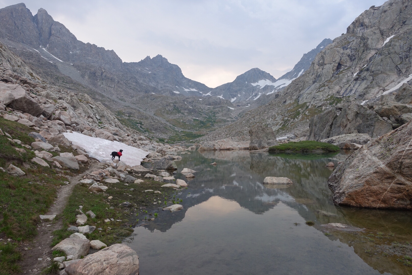
The next 4 or so miles we climbed above tree line to Peak Lake. Easy trail through wildflowers and pine forests gave way to route finding across a massive granite boulder field and snow drifts. One section in particular called for us to boulder-hop up a pretty steep talus field, it was hard work and a bit stressful for Altas, he’d never done anything like it before. We negotiated through it and then across some snow drifts, both of which left him feeling exhausted and so less than a mile short of camp he needed another rest. I let him nap on the trail for 30mins or so while I watched the sun dip behind the opposing canyon wall.
We made it into the upper valley and found a perfect place to set up camp.


Day 3
Peak Lake to the bottom of Titcomb Basin
11.5 miles
Today was incredible! Truly one of the prettiest day of hiking I’ve ever had.
Atlas slept until 6:30 a.m, he was definitely tired from yesterday’s hike! I need to be careful not to push him too hard. We stirred in time to see the sun peaking over Split Mtn and reflect off the lake. The plan today was to cross Knapsack Col and drop down the other side into Titcomb basin. I’d been in this basin once before in 2015, but didn’t get to ascend all the way to the col due to weather, so I was excited to have the opportunity to be here again.
The col was 4 miles away, at the head of the valley, and required largely off-trail navigation. The route wound its way up, passing under Stroud Glacier and over the headwaters of the Green River. Another group was making their way up the valley ahead of me, but they stopped a mile from the lake when the trail petered out. When I caught them they asked me if I knew where I was going because they weren’t sure which way to proceed. I didn’t really know which way to go either, but I put my visual navigation skills to use and was super happy to discover that each time I did I happened across some cairns or footprints soon after which confirmed my choice. They followed for a while but fell back and eventually lost my track, i felt badly for them as they got sucked down into a drainage that was much less direct than the route I took.
Ascending the final pitch to the col was a steep mix of talus, loose dirt and snow drifts, I really don’t enjoy that kind of travel, at all, particularly on my own. But I do appreciate the places it takes me. On normal trail Atlas stops and circles back to me if he gets too far ahead. But on this steep slope, every time he did i’d yell at him to keep going, “Atlas! Go, go, go, go!” I kept saying to him in as excited-a-tone as I could muster. I was worried that if he got next to me he’d push into me with his backpack and knock me off my balance by mistake. It wasn’t super exposed or technical, but a fall in the wrong spot with a heavy pack could definitely have been a bad situation. Atlas seemed to understand and stayed ahead of me and out of my way, what a clever boy!
We made it to the col in 3 hours and wow, the view was absolutely epic. Looking back down at the valley we’d come up was really breathtaking, a sea of granite and snow patches as far as the eye could see.


We took a nice long break to enjoy the view, eat and rest up. For the descent, I had planned to stick to the CDT alternate route, which traverses high around the drainage. The alternative was to drop down into the guts of the drainage below the pass. I’d made that decision in advance to go the high route because I chose not to carry an ice axe or micro-spikes and so descending the guts of the drainage on the snowfield didn’t seem like a good choice. I’d been a little worried about the high route however as the reports I had were that there was a short but pretty exposed and mildly technical section to negotiate right off the pass.
Atlas and I started across the traverse but he was completely freaked-out. The first rock he wouldn’t jump down from and so I had to lift him down. If it had just been me I would have proceeded, but with Atlas wearing his backpack it just didn’t feel safe and I definitely didn’t feel good about proceeding, so we backtracked to the pass again.
I studied the terrain immediately below the pass, a giant snowfield and glacier. I could see a couple of people way below making their way up the guts of the glacier. Hmm. I felt much better about sliding down a snowfield than negotiating that traverse. My only hesitation was a 3 ft cornice that i’d need to slide off and then the obvious issue that it’s a glacier and glaciers have crevasses that can eat you up and keep you forever; it still felt like the safer route. I decided to slide off the cornice into a short talus field, descend the talus field and then slide down the snow, but keeping close’ish to the talus on the other side so if a crevasse swallowed me up I wouldn’t be too far from the edge of it. I also liked the fact there were some people making their way up that would witness the event.
Decision made, I dug the handles of my trekking poles into the snow firmly and proceeded to slowly lower myself over the cornice and onto the rocks below. That wasn’t so hard. But then Mr Atlas didn’t want to come down, he was wining and super anxious taking one step forward then two steps back. I took off my pack, coaxed him over to an easier place for him to get down, then climbed up on a rock to grab him by the handle on his pack and help him down.
We descended the short talus field then needed to get down the rest of the way on snow. Not wanting to lose anything in the descent I secured a bunch of stuff inside my pack but somehow forgot about my water bottle/filter which stayed in an external pocket. I sat on my ass, holding my poles with both hands to one side and slid down using my poles to control my speed and direction. Atlas was so excited! He was sliding down on all fours, eating mouthfuls of snow as he went. Every time my speed slowed he’d jump all over me with excitement. Yep, good choice taking this route for Mr Atlas. Note to self, next time I attempt to slide down a mountain on my ass, chose better apparel than a skirt. Ha.
When the pitch leveled out I stood up and took my pack off to re-sort my stuff that i’d secured inside. It was then I realized my water bottle, but more importantly, water filter wasn’t with me! Argh, how far up did I lose it? What a dumb-ass move! How could I be so stupid? I carry Aquamira drops as a backup water treatment method, but I’m not sure it would have been enough to get me through the whole trip, so i had to find that filter.
Right as I realized my dilemma, one of the hikers made his way up to me, Forest from Montana. The other fellow i’d seen hiking up had apparently decided not to proceed when he saw the headwall and had turned around to go back down Titcomb Basin. Just goes to show, we’re all just out here making our own decisions about what does or doesn’t feel safe, and that’s the way it should be. I felt really good about not being up there on that traverse with a freaked out puppy!
We chatted for a bit and he said he’d look for the filter from above as he made his way up the talus to the right of where i’d slid down. I left my pack where it was and started kicking steps up the slope again, which was really easy without a pack on. Atlas thought the whole thing was a fun game, so he was happily running up and sliding around the slope. We were almost at the top of the snowfield when Forest shouted over “Atlas has it!” and there Atlas stood wagging his tail with my water bottle in his mouth. I gave him a thousand ‘good boys’, thanked Forest, then sat back on my ass and slid back down again. Yep, not a good thing to do in a skirt, but boy was I happy to have that water filter in hand!
The rest of the descent was super easy as I just glissaded down the snow almost all the way to the valley floor. I felt a bit better about it as i could see a number of foot steps trailing across the terrain, none of them disappearing into a crevasse and a lot of it seemed to be more snowfield on talus than snowfield on glacier. The topo map showed the Twins Glacier extending down most of the valley, so it was probably mostly glacier with rocks on it, with snow on-top. My route pretty much hugged the left side of the glacier close to its edge.


We had a good long rest when we got to level ground at the top of Titcomb Basin. Atlas had a nap for an hour or so and I unwound from the whole experience and marveled at this new valley we found ourselves in. I was really happy we’d endured the pass and had the experience we did- from the beauty and grandeur, to the fear and uncertainty, then ultimately the adventure and sense of achievement. After all, life is for living and that was a full morning of living! Definitely Atlas’ most intense day in his young life.
We started down the valley at about 2 p.m. right as thunder started to rumble through the high country. We descended the 6 miles through the basin through rain and thunderstorms, but with intermittent sun poking out between downpours. It doesn’t sound very pleasant, but it was actually a really pretty way to see the basin. Titcomb basin is one of those places, it’s just superbly stunning, layering on the storm added elements of rawness to the intensity that made it ever more special- the smell of rain, battering of wind and vibrations of thunder. The basin itself one pristine lake after the other the whole way down the tight glacially carved drainage. Put Titcomb Basin on your bucket list.
We camped on a hill between Island Lake and where the trail intersects the CDT again. What a fantastic day. We were both exhausted and ready for an early night. I set up camp, fed both of us, hung our food, did my nightly stretching routine and then climbed into the tent for some body maintenance and then bed.
Atlas had developed sores under his arms from his doggy backpack, he had a number of them, and they were pretty raw, the poor little guy. I carried his pack, with all of it’s stuff, from the top of Titcomb Basin down and now looking at his underarms, I was going to need to keep carrying it until his sores got better. Argh! He’d had a sore spot on his chest from his pack on one of the warm-up trips we did earlier in the summer and I thought i’d adjusted the fit of the pack to work well for him, but evidently I had it pulled too far forward or something. I was packing some disinfectant spray and a topical antibiotic to treat such a problem, but with how badly they looked I wondered whether perhaps I should get him some antibiotics sent to our resupply location.
My left knee is always the issue, and happily it had been behaving itself perfectly so far this trip. My lower back had been an issue all summer and it too was behaving itself perfectly. I’ve been going to PT again this summer to continue to diagnose why my right knee causes me issues, as well as to treat the new issue of my back, and I’m thrilled to say that i’m optimistic that what we’ve been working on should treat both conditions, but we’ll see how it does further down the trail. As simple as it sounds, I think my pelvis position was a little off through my walking gait and wasn’t engaging my core, that, in conjunction with stabilizing my left ankle (the one that has only 1 of 3 ligaments on the lateral side), is what we’ve been working on to prepare for this trip. My former PT at Canyon Sports Therapy is on maternity leave and so I’ve gone back to my prior PT at Pinnacle Performance. I think it’s good to get new perspectives on the same issues, so I think we’re going to achieve some good things together at Pinnacle again.
That said, my left achilles tendon was feeling a bit ticked and so I decided to give it some KT tape help for a few days. I also commenced my 3 times a day dessert of 4 ibuprofens, I get the red coated ones because they taste good, it’s almost like eating dessert, almost. With both of us sorted physically we got an early night’s sleep.


Day 4
Bottom of Titcomb Basin to below Hat Pass
13.5 miles
The highlight today was coming up and over Lester Pass, not because it was any kind of technical or physical feat, but because it was absolutely drop dead gorgeous. We’d camped just a couple of miles from the pass and so crossed it in lovely soft morning light. The south side of the pass was a massive basin filled with wild flowers and the trail meandered through them for miles. Wow!!!
We had a lot of streams to ford today but Pole Creek in particular was very wide; as luck would have it, it was only about mid-thigh deep and not moving fast at all. My wonderful fellow CDT’ers had in usual manner, left some sticks marking the very best place to cross the creek. I love the CDT trail community, always looking out for each other.
The excitement for the day were some very big storms that started to form at 1:30 and rolled over in succession until about 7:30 p.m. Unfortunately I had a lot of passes to cross and so had to time the crossing of each between storms. I actually set up the tent in the bottom of a valley at lunch and rested and ate in there for over an hour while one passed over us. I wanted to get us to below Hat Pas before setting up camp for the night so we pushed on, but the mother of all storms chased us to the very end.
The last mile I could hear and see the storm coming up behind me and the second I found a suitable campsite the heavens opened up right on top of us. I set up the tent in no time flat and threw Altas, my pack and myself into the tent in a big pile. The storm was really wild and seemed to last forever. It sat right on top of us for a while with lightning flashes and thunderclaps happening almost simultaneously. Atlas and I each sat on our insulated mats, just in case. One thunder clap/lightning crack was so close we both jumped off our mats and into each others laps, we spent the rest of the storm huddled up together. I was thankful to have him there to comfort me! I HATE lightning, as I’ve said before, give me a wilderness experience filled with grizzly bears over lightning storms, any day!
The storm eventually passed and made way for a gorgeous sunset. We ate, I stretched and we were asleep early, Atlas by 8:30 and me about an hour or so later after studying the next day’s route.
I also took care of some logistics figuring out how to get some antibiotics prescribed by Atlas’ vet and delivered to my resupply point at Big Sandy Lodge where i’d be early the following week. A big thanks to Salt Lake Vet Services who prescribed it and mailed it off for me, the Big Sandy Lodge manager, Natasha, who picked it up from her home address a couple of hours from the lodge (there’s no mail delivery at the lodge- it’s remote) and to my buddy Trover who made some calls to facilitate it all and keep the logistics on track for me. There’s no cell service out here, so I communicated via text from my Garmin GPS device. I like to be disconnected when i’m in the wilderness, but really appreciate the ability to get connected should it be necessary. Technology is a wonderful facilitator for my life and the work I do at Snowbird, but i’m constantly trying to figure out how to minimize its impact on my personal time. I was really happy to see a ‘no drones in the wilderness’ sign posted at the trailhead that I entered from. You get my point.


Day 5
Below Hat Pass to near Raid Lake
13 miles
Today was just a nice cruisy day. Lakes, flowers and creek crossings pretty much sums it up. Really easy hiking through pleasant terrain. As i’d now grown used to, we were treated to a mid-afternoon storm, but this time it came with good-sized hail balls. I crouched down and organized myself, Atlas and my backpack under my little trekking umbrella to ride out the storm. As dorky as it sounds, having that little umbrella is so handy.
I had a decision to make in the afternoon about my route choice. I’d planned to head up into the higher country and do some off-trail travel through Middle Fork Basin, Bonneville Basin and the Pyramid Peak area instead of following the CDT. It would have been unbelievably spectacular and remote, but a slow moving route, with two off-trail passes to negotiate. I ultimately decided not to go that route for a few reasons: my pack was still really heavy as I was still carrying all of Atlas’ food and gear for him; I was concerned at taking him down ‘Pain in the Ass Pass’ with over a half mile of car sized boulders, particularly having seen how he did on the boulders up on Knapsack Col and knowing he wouldn’t be wearing his harness for me to pick him up and help him through difficult sections; and finally because that route would have had me hit Texas Pass in a couple of days time in the afternoon and with the weather pattern of afternoon storms I didn’t think that was a smart plan.
I felt happy with my choice as we passed the trail to Middle Fork Basin. I took a mental snapshot of the trail and high mountains… I will be back someday to see them!


Day 6
Near Raid Lake to Shadow Lake
13 miles
Today was a pretty cruisy day along nice trail and with great views of the big peaks, to my left, the peaks I would have been crossing over had I taken the other route, and ahead the peaks of the Cirque of the Towers that i’ll be camping below tonight.
I was really striding out enjoying the fast miles when all of a sudden my left hip flexor got really painful. It’s a sensation I’ve felt before as the same thing happened when I was about 80 miles from anywhere in the Bitterroot Mountains in Montana/Idaho on the CDT. If you want a good laugh you can read about that situation on Day 34 and 35 of my Montanaho post.
I found a good spot to take a long break and thought about my hip flexor. I decided not to stretch it, as last time that seemed to exacerbate it and maybe the issue is that it’s been stretched too much and not too little. Instead I taped it with KT tape, rested for an hour and a half before getting back on the trail, upped my ibuprofen intake to six 3 times/day for a couple of days and stopped stretching it each night. What do you know, it did the trick!
The afternoon was super scenic as the trail traveled along a plateau and then dropped down into a valley right behind the Cirque of the Towers. I left the CDT and headed up towards Texas Pass, I’ll see the CDT again after my resupply stop at Big Sandy Lodge and travel along it through the south-end of the range.
I passed a bunch of NOBO (northbound) CDT hikers today. It was so great to be part of the trail community again, introducing myself as Elevated for the first time in a long while and talking trail talk. Everyone I talked with mentioned the snow in Montana, not because there is any yet, but because they were feeling the urgency to get up to Montana and through the mountains before the start of the fall snow storms. I had felt the same thing going SOBO at this point of the trail, except for me the threat was snow in the San Juan mountains in southern Colorado. It’s a short hiking season to get through that many miles. I felt happy to be a leisurely section hiker this trip, it’s nice not to have the pressure!
I found a nice place to camp at Shadow Lake, despite the fact there were a bunch of other people there. I had been expecting an influx of trail traffic from here to where I resupply as it’s a popular area of the mountain range, so the trail traffic didn’t bother me too much. As it turns out it didn’t storm that afternoon and I could have pushed on another mile and had Billy Lake to myself, but Shadow Lake was a much better place to be camped had there been a lightning storm, so i’m good with the decision.
Setting up camp I became aware that for the first time on the trail I had to contend with bad mosquitos. I was expecting really bad mosquitos the whole trip and so brought along my Thermacell Radius device which to this point i’d only used briefly a few times. Glad to have had it, I turned it on and watched with awe as the mosquitos slowly backed off and then stayed away completely. I set up camp and ate my dinner in peace. After that, Atlas and I went down to the lake’s edge to watch the sunset and then retired to our tent for an early night.


Day 7
Shadow Lake to near Big Sandy Lake
9 miles
Spending today in the presence of the Cirque of the Towers was definitely a highlight of the trip.
I hit the trail early as I wanted to get up and over both Texas Pass and Jackass Pass before the afternoon storms set in. Unfortunately for me, the weather gods decided to start the day off with rain. So, I made my way up past Billy and Texas Lake in light to moderate rain. At first I was disappointed to see the rain as I thought it may make the rock slippery that I needed to clammer up to get to Texas Pass. However then I realized that while that may be a little the case, it had the wonderful benefit of turning any loose chalky dirt and pebbles to a tacky surface that would actually be way easier to walk up. Keep on raining dear weather gods, but a mere drizzle if you would!
The weather gods indulged me and it drizzled lightly as I approached the pass and then stopped completely for most of the ascent. The route was pretty easy going, the bottom half was easy talus hopping or kicking steps up a snow drift and the top half was walking up steep loose dirt and rocks, which as I’ve said were in perfect condition. Mr Atlas and I smoked it and were up on the pass in under 40 minutes.


The pass was much wider than I was expecting and so the view into the Cirque of the Towers slowly unfolded in front of me as I walked nearer to the other side of the pass. I’d been carrying a Happy Birthday cookie for Atlas the whole trip looking for the right place to celebrate his 1yr birthday, and this was to be it. I laid the cookie out on a rock for him overlooking the Cirque of the Towers, gave him a big pat and let him have at it. Happy Birthday, Mr Atlas.


After the birthday celebrations we started down from the pass. There was a big snowfield and the route traversed across the top of it. Five Star, a CDT hiker i’d talked to yesterday, told me to ignore the footsteps and just go straight down the snowfield or to its right. I studied the route and it looked very straightforward with no risk, so decided to sit on my ass and slide down the whole thing, just as I had on Knapsack Col earlier in the trip. The plan went off without a hitch, I was to the bottom of the snowfield in no time and very happy to have saved the time walking it. The funny thing was how Atlas reacted, instead of sliding down next time me on all fours like he did from Knapsack, he was running down it biting down on my trekking pole handles and trying to pull me off to the side. I’m not sure if he was trying to slow me down and stop my slide, or if he was just doing it because he was excited. Funny boy.
We continued the descent, keeping the stream to my left until an obvious bench about half way down and then traversed across to meet up with a faint trail to continue the rest of the way. I stopped for a break in a field of wildflowers and granite boulders with a magnificent view of the cirque. Atlas napped for about an hour and I lay back, basked in the sun and took in the mighty views. My buddy, Trover, has done a lot of climbing here and so I studied the rock faces wondering which of them he’d climbed, or perhaps knowing him, which he hadn’t climbed. I could hear the occasional climber somewhere in the valley shout “on belay” or “rope”, but the tiny people were lost in the scale of it all and I was left wondering where they were.
We got to Lonesome Lake at the bottom of the valley and Atlas launched in for a swim. There’s not much in life that makes him happier than swimming, except maybe eating and tennis balls. Happy boy.
We traversed the west side of the lake and made our way up to Jackass Pass. I thought it’d be quicker, but in hindsight it might have been easier on the east side with a dog because I had to do a little boulder hopping. When I got to the pass the storm clouds had rolled back in and some faint thunder grumbles had started. The pass had been just a walk to get to, so there wasn’t a need to pause to celebrate the achievement of getting there, but I did pause to really enjoy the views one last time. The Cirque of the Towers is truly breathtaking. Wow.
The trail from the pass was super obvious and so I didn’t even stop to study my maps before starting down. I met some Forest Service guys walking in to get to a project site. We chatted briefly and I thanked them for what they do, I couldn’t help myself and added “there aren’t that many of you anymore, it’s kind of like spotting an endangered species animal, I feel real lucky”. They knew exactly what I was talking about and cracked up laughing. In case you’re not aware, funding for the Forest Service has been totally obliterated under the Trump administration and so there’s a lot of stuff not getting done. That’s all I’m going to say about that.
Before parting ways I asked the guys if they wouldn’t mind taking a photo of Atlas and I, it turned out hilariously because after posing normally for 10 seconds Atlas out of nowhere decided to get up from his sitting position and instead jump up and put his arms on my shoulders and give me a giant hug. So funny, and made for a great picture of the two of us. Ha.


The prominent trail took us to Arrowhead Lake, but then disappeared into a sea of massive car and house sized boulders. Ummm? I looked across the valley and the other bank of the lake was a cliff, so this had to be the route, right? Argh. I stood there and studied the mess of rock for a while and noticed a couple of different sets of cairns going through it. The route I chose quickly became a dead-end, it would have been very doable as a human but the set of moves required to make it through with Atlas weren’t possible. I turned around and started back, but some of the boulders he’d come down had proved to be impossible for him to get back up, so I had to take of my backpack and help push him up some parts, he wasn’t happy!
Another group of hikers had converged on the rock mess by this time and they had 4 dogs with them. I told them how it had gone on my route so they started along the other route. I followed them and was thankful for their help lifting Atlas up one boulder. We got to a bit of a crux point and one of the guys went out ahead to scout out the rest of the crossing.
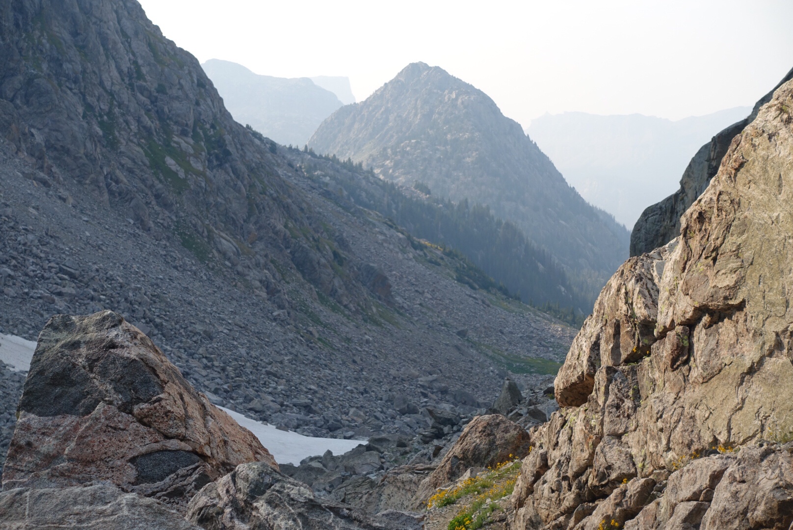
As I sat there I just couldn’t figure out how this could be the route. I pulled out my phone and studied my maps and what do you know, the route was on the other side of the lake! It started about half way down from the pass and traversed the rock bench at the top of the cliff on the other side of the lake. I looked up at it and noticed some footsteps traversing a snow drift and figured that was it, I mustn’t have seen the trail fork because it was covered in snow. Ah hah! I shared the info with the group and made the very easy decision to turn around, backtrack to the actual trail and continue on the other side of the lake. They decided to proceed through the mess of boulders. Here’s the boulder-field from the other side of the lake:

Unfortunately the storm had definitely arrived by this point and I found myself walking in the rain and thunder on a bench below a massive granite peak. Have I already told you how much I hate lightning? Well, one of the places you definitely don’t want to be in a lightning storm is at the bottom of a rock face because rock conducts electricity really well. I moved my legs as fast as I could and happily got down from the rock before the worst of the storm set in.
Relieved to hit tree line our pace slowed considerably. I stopped above North Lake to sit under my umbrella with Atlas while the heavy rain came down. As the rain was abating the group with the dogs came hiking down the trail. They laughed to see i’d beaten them down, I was so relieved to see them because i’d been worried for them. We chatted a while before they continued down the trail.
We found a good camp in a meadow about a quarter mile above Big Sandy Lake. It had nice views across to the Temple Peak valley. It was only 5 p.m. but Atlas was ready for another nap and we only had to go 8 miles the next day to our resupply point at Big Sandy Lodge, so I decided to stop.
The wind was ripping along pretty strongly so I opened my hiking umbrella and stuck it in the vestibule to help keep more of the wind from coming into the tent. The sleeping temps on this trip have been cold, so a strong wind draft wouldn’t have helped. I really love this umbrella, today alone it came in handy twice.


Day 8
Near Big Sandy Lake to Big Sandy Lodge
8 miles
I woke like I normally do, to Atlas stirring. I unzipped the tent fly and let him out to stretch his legs. He always starts the day with a bit of yoga, usually downward dog to cobra. So cute!


I packed up camp and we were on the trail by 7:30. Even thought I absolutely love being in the wilderness on these adventures, hitting the trail knowing it’s a ‘town day’ is always really exciting. It’s not really a town day, but I am heading to the Big Sandy Lodge, a remote lodge a couple of miles from the Big Sandy Trailhead, to pick up my resupply package and rest for a day.
The trail dropped down and followed along Big Sandy Lake. Boy was I happy I hadn’t camped there, lots of tents. Big Sandy Lake is about 6 miles from the Big Sandy Trailhead, one of the major trailheads leading into the Winds, and so it’s a popular place for people to camp.
I have a rule against using my devices while i’m walking. You may remember the story behind why? It’s a funny one. I was hiking the CDT in the Salmon National Forest a couple of summers ago. The stretch of trail was pretty flat and I had my phone out using one of my navigation apps, when all of a sudden I tripped on a root and my stuff and I went flying. I didn’t hurt myself but it was a wake up call to pay attention to the trail and not my device.
So, here I was, walking the shore of the Big Sandy Lake looking at my phone to see if I was on the correct trail when all of a sudden I tripped on a rock and went flying. I went down hard and broke the brunt of my fall with the palm of my hand. I picked myself up and assessed the damage, everything was fine except i’d scraped a quarter-sized flap of skin off my palm and it was bleeding. I squirted some water on it to get the dirt out of it, put a glob of Neosporin on it, taped some gauze to it to stop the bleeding and put my sun-glove back on to hold it all in place. Argh. It was throbbing. This is exactly why I shouldn’t walk and use my devices, distracted walking!
I took the less traveled trail to the lodge, bypassing the main trailhead and instead walking by V Lake and eventually coming in the horse trail to the lodge property. The trail was mellow and flew by quickly. I spent the whole time thinking about what I hoped would be on the dinner menu at the lodge that night and the verdict was baked beans. Baked beans? Not steak or fruit or salad, but baked beans. Where do I get these weird hiking cravings?


I arrived at the lodge by about 11. I went into the main lodge house and after shouting out hello a few times, was greeted by the cook, Matt. He told me everyone else was out dealing with a goat. The wranglers had come across a pack-goat on the trail a few days ago in the wilderness and had brought it back to the ranch with them. They’d matched it to a “lost goat” flyer at the main trailhead and the owner was en route from Utah to retrieve the lost goat.
Matt, went to find the Manager, Wes, who checked me in and showed me around the property, which consisted of the main lodge, lake, cabins and a bathroom block. I dropped my stuff in my cabin and went back to get my resupply boxes, 1 for me and 1 for Atlas. It was pretty fun for me to see Atlas’ reaction as I opened his box because there were a whole bunch of treats in there for him. I gave him a cows’ ear and he plopped down outside the cabin to chew on it.
Matt asked me what I wanted on the dinner buffet and he was amused to hear my response, “Baked beans?” “Well, okay” he said, “we probably have a tin somewhere, but is that really want you want after being out in the wilderness?” My response, an excited “oh yes!”
I was happy to see a clothes line and so washed some laundry in a bucket in the bathroom and hung it to dry. There’s no way to describe how much dirt came out of my clothes, even after my 4th or 5th attempt to wash them. Hiking in the same clothes for 8 days is gross, there’s no doubt about it, but it’s a necessity if I’m to keep an ultra-light backpack weight.
Atlas and I took an afternoon nap and by the time we woke it was 6 p.m. and time for dinner. I joined the only other people staying at the lodge, Butch and Martha, and enjoyed a delicious buffet of pork, brussel sprouts, potatoes, cornbread and, of course, baked beans.
After dinner I decided it was about time I took care of the wound on the palm of my hand. I removed the gauze and discovered that the skin flap had partially re-formed to the surrounding skin. I figured it would be a bad idea to leave it as is, because there was probably still dirt and dried blood caught between the old and new skin. My multi-tool knife has a small pair of tweezers on it, so I used those to slowly rip the skin back, and then eventually off all together. It was totally gross. I disinfected it with rubbing alcohol to clean it up, put Neosporin on it and then covered it with a band-aid that Butch had given me. It’s the first time in my backpacking career that I can recall having to deal with a wound. Hope it’s the last, I hate blood. No more distracted walking!


Rest Day
Big Sandy Lodge
Big Sandy Lodge is pretty remote and no-frills, it’s 44 miles from the nearest town, and has no electricity, phone or cell reception. In other words, it’s perfect.
The site was originally used as a base camp for Wind River adventures by Finis Mitchell in the 1920s, Finis was a Wyoming mountaineer and politician who became an authority on the Wind River Range. In a book he authored on the range, he offered this observation: “A mountain is the best medicine for a troubled mind. Seldom does man ponder his own insignificance. He thinks he is master of all things. He thinks the world is his without bonds. Nothing could be farther from the truth. Only when he tramps the mountains alone, communing with nature, observing other insignificant creatures about him, to come and go as he will, does he awaken to his own short-lived presence on earth.” I think I would have liked Finis Mitchell.
Atlas let me sleep in until nearly 7 a.m. Hooray! I took him for a quick walk and popped him back in the cabin just as Matt rang the meal bell outside the main lodge. I sat down with Butch and Martha for a delicious breakfast of French Toast, bacon, potatoes and fruit.
I spent some time wandering around the small lodge, the walls covered in maps of the mountain range or photos from beautiful places within it. I was happy to see a small library of books. The last remote mountain lodge I stayed at was Benchmark Range in the Bob Marshall Wilderness in Montana. It wasn’t exactly a lodge, more a basic cabin I rented for a couple of nights; it had no main lodge and the only book in the cabin was a book about the secret life of Fergie, Dutchess of York. So, suffice it to say, I was very happy to see a selection here at Big Sandy Lodge. The situation got even better as I discovered a hardcover book on the American Wilderness with essays by John Muir and pictures by Ansell Adams. Score!
I spent most of the morning sitting by the lake enjoying the essays and pictures. One essay in particular really resonated with me, ‘A Wind Storm in the Forests’, where Muir climbs a 100-foot Douglas Spruce during a storm and describes how wind moves through a forest. A couple of passages below I really enjoyed:
“Most people like to look at mountain rivers, and bear them in mind but few care to look at the winds, though far more beautiful and sublime, and though they become at times about as visible as flowing water.“
“The view from here must be extremely beautiful in any weather. Now my eye roved over the piny hills and dales as over fields of waving grain, and felt the light running in ripples and broad swelling undulations across the valleys from ridge to ridge, as the shining foliage was stirred by corresponding waves of air.“
I had a good sleep in the afternoon, organized my pack and looked at the maps for the next stretch of trail through the south-end of the Winds to Atlantic City.
Atlas enjoyed his rest day also, he pretty much slept all day or ate the treats he got in his resupply box. Happy Atlas! I’m so proud of how well he did this first stretch of trail. I think he’s going to develop into a great thru-hiking dog.


Thanks for reading.
-Elevated


Hey Kate! A timely post for us; we leave Monday morning for another backpack to the Winds. Although we won’t be heading over Texas Pass we do plan to detour to Shadow Lake. We decided against Jackass and after reading your post are glad we did. Our Ridgeback is a pretty sturdy dog but his two humans are getting on in years. We did the Green River entrance last year so this time going in at Big Sandy, looping around Grave Lake and “lolly popping” back to Big Sandy. Thanks for the fun read.
Great read Kate & Atlas.
Hi Kate! I’m working on some trip planning for this route for a jaunt this coming August. I was considering started south and working my way north as that works a best smoother logistically. But nearly all posts start north and head south. Why is that? Less elevation? Any advice?
Thanks 🙂
Hi there. Either way works and people do. There might be some lingering snow on Knapsack Col and Texas Pass which hold snow… you’d be doing that going uphill going northbound. I enjoyed being able to slide down on by butt (Atlas loved that) instead of dealing with traveling up a snowfield. But I passed people going up those same areas, so it’s no big deal.
Elevation depends on where you come in/out but assuming you started at Big Sandy TH and finish at Green River Lakes TH, it’s about even elevation gain/loss. If you hike the CDT proper southbound it’s about 13,600 ascent and 12,200 descent; and if you take the Cirque of the Towers and Knapsack Col alternate routes (highly recommend both!) it’s about 16,700 ascent and 15,300 descent. So, really similar on both routes.
Let me know if you’ve got any other qs. The Guthooks App for CDT Wyoming might be super helpful to your planning? It has all the stuff you need to know marked at waypoints, along with user generated comments that relate eg. water sources, snow crossing, trailhead logistics etc.
Have fun! -Elevated